As winter continues, parts of the country are seeing a mix of mild weather and potential storm activity. Here’s what you can expect in the coming days, along with insights into a possible winter storm next weekend.
Mild Overnight Temperatures
Overnight temperatures are expected to remain on the mild side, thanks to mostly cloudy skies and southerly winds. Low temperatures will range from the upper teens to the low 20s, making it relatively comfortable for January standards. This mild start sets the stage for an overall calm and pleasant weekend.
Weekend Weather Outlook
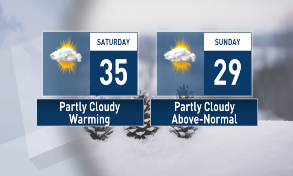
Saturday
Temperatures: Highs are predicted to climb into the low to mid-30s in northern counties and hover around the low 30s in southern counties.
Cloud Cover: The day will start with mostly cloudy skies, transitioning to a mix of clouds and sun by the afternoon. By evening, skies will become partly to mostly clear.
Nighttime Temperatures: Saturday night will feel cooler as a weak cold front moves through. Lows are expected to drop into the low to mid-teens.
Sunday
Temperatures: Sunday’s highs will rise into the upper 20s and low 30s. A brief cooldown will follow the passage of the cold front.
Nighttime Temperatures: Lows will settle in the upper teens and low 20s as the weekend wraps up.
Despite the short-lived dip in temperatures, the weekend will feel mild overall, offering a break from the harsher conditions of midwinter.
Warming Trend Next Week
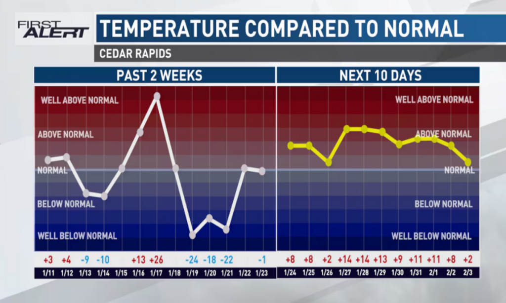
A larger-scale warming trend is on the way, bringing temperatures that are warmer than average for this time of year. Highs throughout the week are forecasted to reach the 30s and 40s, while lows will generally remain in the teens and 20s. This warmer-than-usual pattern should provide a reprieve from the deep chill often associated with January.
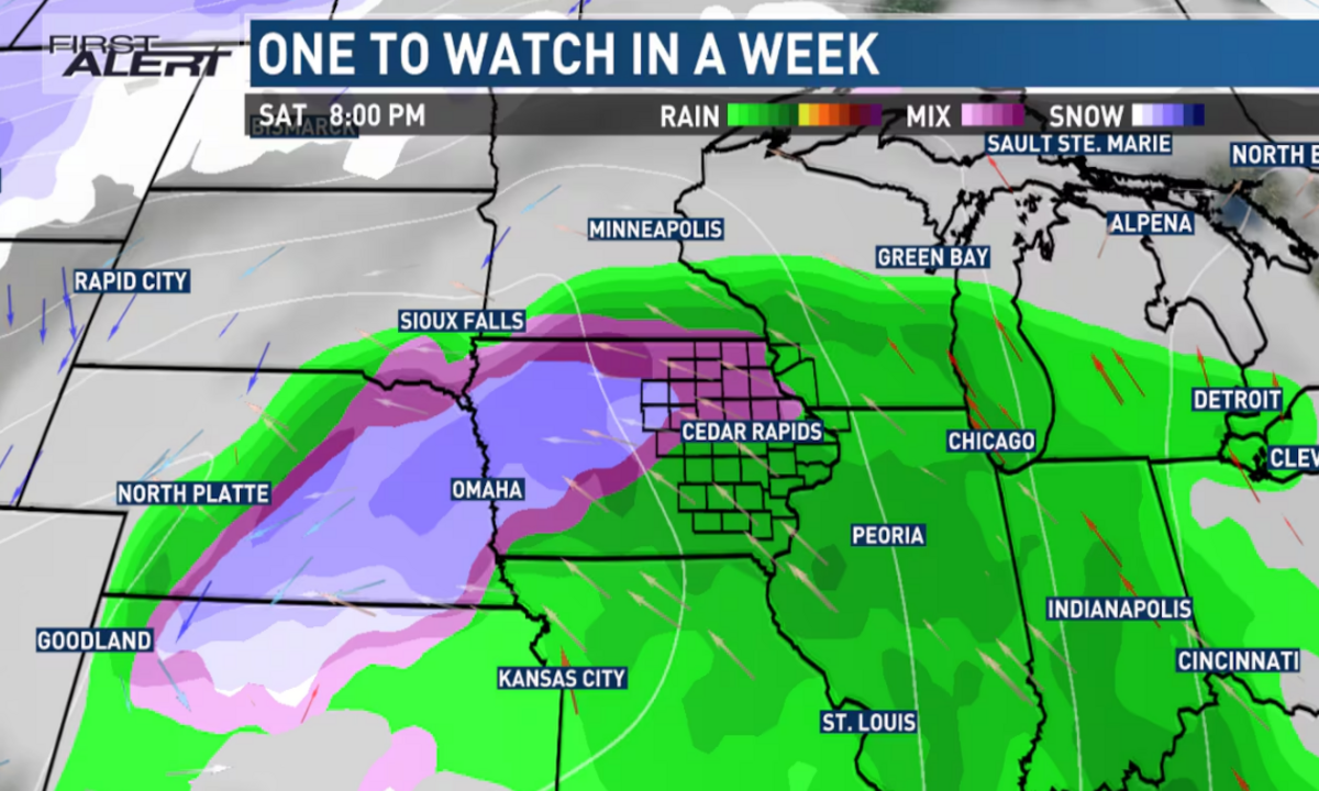
Possible Winter Storm Next Weekend
Looking ahead, a potential winter storm is being closely monitored for next weekend. Current forecasts suggest the storm could move across the middle of the country, potentially affecting parts of eastern Iowa and surrounding areas. While it’s too early to pinpoint specific details, here are some key points to consider:
Precipitation Types: Depending on the storm’s track and temperature profile, it could bring rain, snow, or a wintry mix.
Timing: The storm is still over a week away, leaving plenty of time for updates as meteorologists refine predictions.
Impact: Factors like the storm’s strength, timing, and precipitation type will determine how much of an effect it has on the region.
This is your First Alert to a potential winter storm. Stay updated with reliable weather forecasts as new information becomes available. If the storm materializes, it’s always a good idea to prepare ahead of time with essential supplies and travel plans.
How to Prepare for Changing Winter Conditions
Stay Informed: Check daily weather updates and alerts to keep track of changes in the forecast.
Prepare Your Vehicle: Ensure your car is winter-ready with an ice scraper, jumper cables, and a full tank of gas.
Plan Ahead: If snow or ice is expected, consider stocking up on essentials and avoiding unnecessary travel.
Dress for the Weather: Layers, hats, gloves, and insulated boots will help keep you warm in colder conditions.
Final Thoughts
While the upcoming weekend and early next week promise mild weather, the possibility of a winter storm adds an element of uncertainty to the forecast. Keep an eye on updates and prepare accordingly to stay safe and comfortable during this dynamic winter season. Whether it’s enjoying the mild temperatures or gearing up for potential snowfall, being prepared is the key to making the most of the days ahead.